Tag: map
-
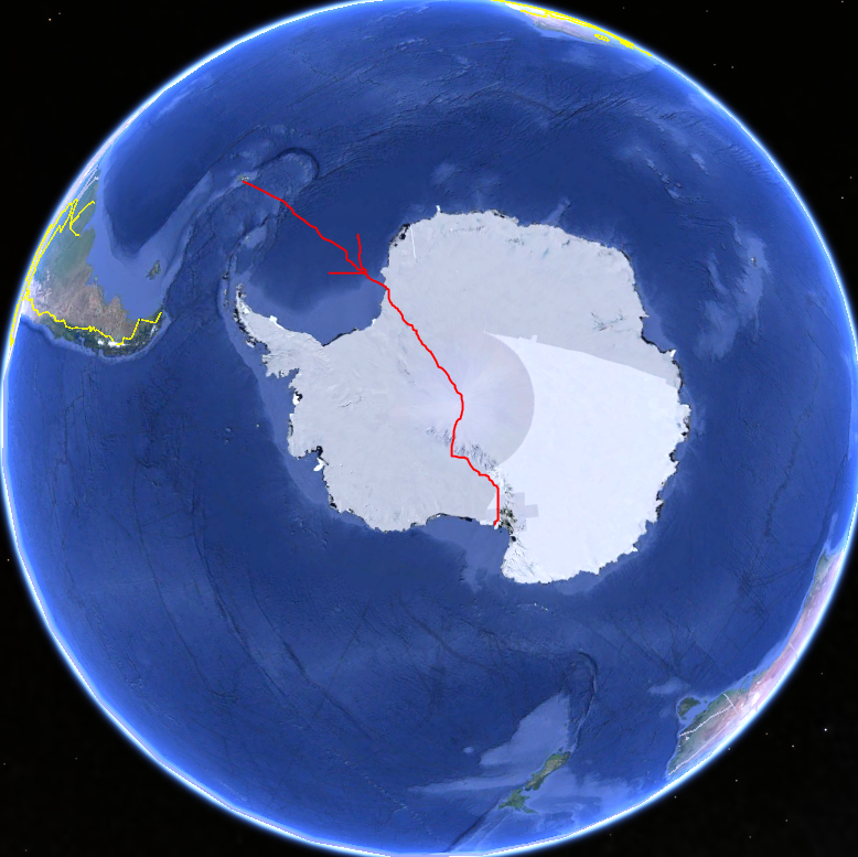
1914 Trans-Antarctic Expedition Map
It’s still baffling to me how Shackleton thought this was a good idea. Compare the size of Antarctica and the Southern Ocean around it to the Northern hemisphere. It’s over 2,100 miles on land alone; approximately the same distance as a dogsled trip from Seattle, WA, to northern Michigan.
-
The hazards and joys of bus commuting
I’ve been riding the bus to work for over five months. People frequently ask me what it’s like, so I present to you the good, the bad, and the ugly of bus commuting in Louisville, Kentucky. (See 12/15 UPDATE at the end about the bus breaking down.)
-
Soundtrack into space
-
Free maps
“Google Maps are free as in beer, not as in speech,” reads the OpenStreetMap FAQ. I’ve always been fascinated by maps, so I thought it would be helpful to provide an update on the use of maps online. Google allows the dynamic use of maps through their API, but you’re not allowed to take screenshots…